Geotomo Software RES3DINV x64 Pro v3.14.20
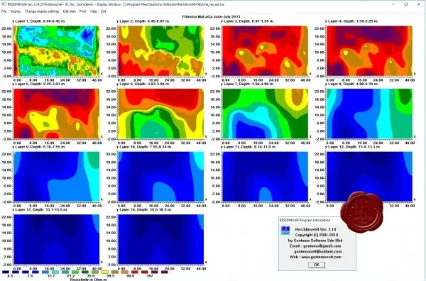
RES3DINVx64 - 3D RESISTIVITY & IP INVERSION software. In areas with complex structures, there is no substitute for a fully 3D survey.

The arrays supported include the pole-pole, pole-dipole, inline dipole-dipole, equatorial dipole-dipole and Wenner-Schlumberger and non-conventional arrays. The RES3DINV program uses the smoothness-constrained least-squares inversion technique to produce a 3D model of the subsurface from the apparent resistivity data. The RES3DINVx64 Basic program supports up to 8 GB RAM, while RES3DINVx64 Professional supports up to 192 GB RAM.
The data inversion takes less than a minute for small surveys with 100 electrodes in a flat area, to about an hour for extremely large surveys with 3000 electrodes in rugged terrain. The program will automatically choose the optimum inversion parameters for a data set.
However, the parameters that affect the inversion process can be modified by the user. The inversion settings can be optimized for areas where the subsurface resistivity varies in a smooth manner, or optimized for areas with sharp boundaries. Topographic effects can be incorporated into the model by using a distorted finite-element grid such that the surface of the grid matches the topography
112MB
Download
*
RES3DINVx64 - 3D RESISTIVITY & IP INVERSION software. In areas with complex structures, there is no substitute for a fully 3D survey.

The arrays supported include the pole-pole, pole-dipole, inline dipole-dipole, equatorial dipole-dipole and Wenner-Schlumberger and non-conventional arrays. The RES3DINV program uses the smoothness-constrained least-squares inversion technique to produce a 3D model of the subsurface from the apparent resistivity data. The RES3DINVx64 Basic program supports up to 8 GB RAM, while RES3DINVx64 Professional supports up to 192 GB RAM.
The data inversion takes less than a minute for small surveys with 100 electrodes in a flat area, to about an hour for extremely large surveys with 3000 electrodes in rugged terrain. The program will automatically choose the optimum inversion parameters for a data set.
However, the parameters that affect the inversion process can be modified by the user. The inversion settings can be optimized for areas where the subsurface resistivity varies in a smooth manner, or optimized for areas with sharp boundaries. Topographic effects can be incorporated into the model by using a distorted finite-element grid such that the surface of the grid matches the topography
112MB
Download
*