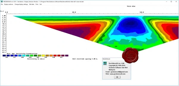
Geotomo Software RES2DINV x64 v4.8.9
RES2DINVx64 - 2D RESISTIVITY & IP INVERSION software. Two-dimensional (2D) electrical imaging surveys are now widely used to map areas of moderately complex geology where 1D resistivity sounding surveys are inadequate. The RES2DINVx64 programs use the smoothness-constrained Gauss-Newton least-squares inversion technique (Sasaki 1992) to produce a 2D model of the subsurface from the apparent resistivity data. It is completely automatic and the user does not even have to supply a starting model. On a modern PC, the inversion of a single pseudosection is usually completed within seconds to minutes. It supports the Wenner, Schlumberger, pole-pole, pole-dipole, dipole-dipole, multiple gradient and non-conventional arrays.
The program will automatically choose the optimum inversion parameters for a data set. However, the inversion parameters can be modified by the user. The smoothing filter can be adjusted to emphasize resistivity variations in the vertical, horizontal or diagonal directions. It can also be optimized to produce models with smooth boundaries (for eg. chemical plumes), or with sharp boundaries (for eg. fracture zones). Resistivity information from borehole and other sources can also be included to constrain the inversion process. Known boundaries where an abrupt change in the resistivity occurs can also be incorporated in the inversion model. Three different techniques for topographic modeling (Loke 2000) are available. The complex resistivity method (Kenma et al. 2000) is used for IP data inversion.

42.1MB
Download
*
RES2DINVx64 - 2D RESISTIVITY & IP INVERSION software. Two-dimensional (2D) electrical imaging surveys are now widely used to map areas of moderately complex geology where 1D resistivity sounding surveys are inadequate. The RES2DINVx64 programs use the smoothness-constrained Gauss-Newton least-squares inversion technique (Sasaki 1992) to produce a 2D model of the subsurface from the apparent resistivity data. It is completely automatic and the user does not even have to supply a starting model. On a modern PC, the inversion of a single pseudosection is usually completed within seconds to minutes. It supports the Wenner, Schlumberger, pole-pole, pole-dipole, dipole-dipole, multiple gradient and non-conventional arrays.
The program will automatically choose the optimum inversion parameters for a data set. However, the inversion parameters can be modified by the user. The smoothing filter can be adjusted to emphasize resistivity variations in the vertical, horizontal or diagonal directions. It can also be optimized to produce models with smooth boundaries (for eg. chemical plumes), or with sharp boundaries (for eg. fracture zones). Resistivity information from borehole and other sources can also be included to constrain the inversion process. Known boundaries where an abrupt change in the resistivity occurs can also be incorporated in the inversion model. Three different techniques for topographic modeling (Loke 2000) are available. The complex resistivity method (Kenma et al. 2000) is used for IP data inversion.

42.1MB
Download
*