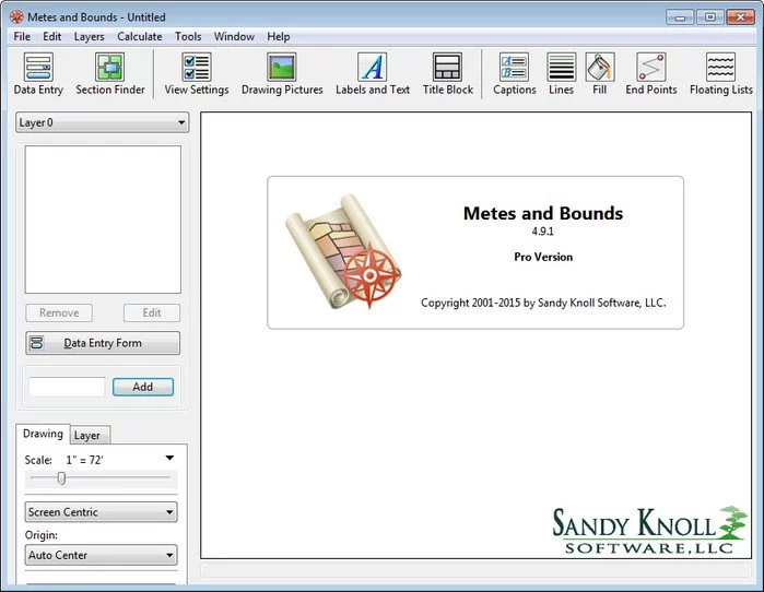
Metes and Bounds Pro 6.1.0
Turn Metes and Bounds data into a deed plot.Auto-completion, Area Calculation, Custom Labels, Sections, Layers, GPS, Compass Rule Adjustments and more. Easy to use data entry form: Enter lines, curves, azimuths and section calls. Data can be entered using the convenient Data Entry Form or freehand using word processor style entry. Calls can also be easily drawn using the call drawing tool.

Customizable Toolbar: Create an interface that fits to your workflow.
Layers: Layers allow you to have multiple deeds on a single drawing. Layers can be free floating or locked to a common starting point.
Perform calculations: Square Feet, Acres, Hectares, perimeter distance and more.
Metes and Bounds will calculate if the survey closes or not. Calculate closure errors: closing error ratios and the call needed to close the plot. Apply Compass Rule Adjustments.
The Metes and Bounds closing error analyzer tool can look for common entry or survey errors and offer suggestions on how to correct them.
Auto-Completion of drawing. If you're missing the final segment of your land plotting data, let our Metes and Bounds land plotting software finish it for you. Have a bad or missing call? Enter a question mark (?) for the call and let the software find the missing call for you.
Multiple measurement types: Data can be entered using feet, meters, rods, chains, varas and many other measurement types.
Merge Layer: Layers can be easily merged into a single layer using the Merge Layer Tool.
Easy to use measuring tool. Estimate the distance between any two points on the screen.
Automatic labeling: Each line can be automatically labeled with the length and call. End points can be marked for easier recognition. End points can also be labeled with information like the interior/exterior angles and Lat/Long coordinates.
Create custom labels. Custom labels can be rotated in any direction. Drawings can include a call list:
Metes and Bounds Call List - Try our deed plotter for free.
Background Pictures. Background pictures can be set to scale with your plot drawing. Background picture scale settings can be automatically set using World Files.
Custom X,Y points. Use custom X,Y points to mark and label unique land features on the metes and bounds drawing.
Split a single plot into multiple plots. Split the plot by hand, or choose a starting point and let the Metes and Bounds software find the nearest halves automatically for you.
Size: 35.4 MB
Download
*
Turn Metes and Bounds data into a deed plot.Auto-completion, Area Calculation, Custom Labels, Sections, Layers, GPS, Compass Rule Adjustments and more. Easy to use data entry form: Enter lines, curves, azimuths and section calls. Data can be entered using the convenient Data Entry Form or freehand using word processor style entry. Calls can also be easily drawn using the call drawing tool.

Customizable Toolbar: Create an interface that fits to your workflow.
Layers: Layers allow you to have multiple deeds on a single drawing. Layers can be free floating or locked to a common starting point.
Perform calculations: Square Feet, Acres, Hectares, perimeter distance and more.
Metes and Bounds will calculate if the survey closes or not. Calculate closure errors: closing error ratios and the call needed to close the plot. Apply Compass Rule Adjustments.
The Metes and Bounds closing error analyzer tool can look for common entry or survey errors and offer suggestions on how to correct them.
Auto-Completion of drawing. If you're missing the final segment of your land plotting data, let our Metes and Bounds land plotting software finish it for you. Have a bad or missing call? Enter a question mark (?) for the call and let the software find the missing call for you.
Multiple measurement types: Data can be entered using feet, meters, rods, chains, varas and many other measurement types.
Merge Layer: Layers can be easily merged into a single layer using the Merge Layer Tool.
Easy to use measuring tool. Estimate the distance between any two points on the screen.
Automatic labeling: Each line can be automatically labeled with the length and call. End points can be marked for easier recognition. End points can also be labeled with information like the interior/exterior angles and Lat/Long coordinates.
Create custom labels. Custom labels can be rotated in any direction. Drawings can include a call list:
Metes and Bounds Call List - Try our deed plotter for free.
Background Pictures. Background pictures can be set to scale with your plot drawing. Background picture scale settings can be automatically set using World Files.
Custom X,Y points. Use custom X,Y points to mark and label unique land features on the metes and bounds drawing.
Split a single plot into multiple plots. Split the plot by hand, or choose a starting point and let the Metes and Bounds software find the nearest halves automatically for you.
Size: 35.4 MB
Download
*