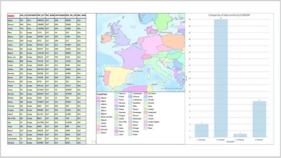
Making Maps and Map Series using ArcGIS Pro Layouts
Map Books made easy!
What you'll learn:
ArcGIS Pro
Desktop GIS
Making Maps
Making Map Series (Map Books)
Map Books made easy!
What you'll learn:
ArcGIS Pro
Desktop GIS
Making Maps
Making Map Series (Map Books)

Requirements
Have a license to use ArcGIS Pro
Have a laptop or PC that meets ArcGIS Pro system requirements
Preferably to have already completed Exploring Spatial Information using ArcGIS Pro
Description
ArcGIS Pro is Esri’s flagship desktop GIS product, and it was first released in 2015. This course was recorded using ArcGIS Pro 2.6 and 2.7.
It is designed for those who are new to ArcGIS Pro, and also for those who just want to learn more about how to use ArcGIS Pro layouts for making maps and map series. It will be an advantage to have taken its companion course titled Exploring Spatial Information using ArcGIS Pro prior to taking this one.
The scope of these two companion courses may touch upon, but excludes in depth examination of, large topics like editing spatial data, and geoprocessing using tools, models, tasks and the ArcPy module for Python. There is already a third full-length companion course available for ArcPy (ArcPy for Python Developers using ArcGIS Pro), while companion courses for the other topics are in development.
Many sections of this course can be taken in any order. You just need to download the data, and check that you have ArcGIS Pro working first.
The course requires only a Basic level license of ArcGIS Desktop (which includes ArcGIS Pro), and no extension products need to be licensed, in order to complete all exercises.
If you do not have an ArcGIS Desktop license then, for about $100-150 per annum, it is possible to use an Advanced level license and many of the extension products for non-commercial purposes (like taking this course!), via Esri’s ArcGIS for Personal Use program.
It is also possible to undertake a 21-day free trial of ArcGIS Pro.
The course takes an in-depth tour of the most commonly used ArcGIS Pro features for making maps and map series from layouts. The scenarios chosen to illustrate how each feature is used are derived from the presenter’s experience working with ArcGIS Pro for 5 years, and with Esri software for more than 30 years.
In this 7 hour course of 41 lectures, which is suitable for English-speaking students from anywhere in the world, things that you will use and learn include:
Downloading Natural Earth Data
Starting ArcGIS Pro to check its version
Creating and deleting Projects
Making PDF Maps and Map Books
Using Layout and Map Frame Galleries
Listing Layouts in the Contents Pane using different Views
Navigating Layout Page and Maps in Map Frames
Working with Layout Properties
Sizing and positioning Layout Elements
Using Rulers, Guides and Printer Margins
Working with Static and Dynamic Text Elements
Formatting Text Elements
Using Shield and Callout Symbols in Text Elements
Working with Graphics, North Arrows and Pictures
Manipulating Layout Elements
Working with Scale Bars
Working with Legends
Working with Legend Items and Patches
Working with Grids and Graticules, and their Properties
Formatting Measured Grid Labels
Aligning Neatlines, Map Frame and Legends
Working with Table Frames
Working with Chart Frames
Using the Map Frame Ribbon
Working with Map Frame Properties in the Element Pane
Reshaping Map Frames to be Non-rectangular
Using Extent Indicators and Leaders for Overview and Index Maps
Using Local and Global Scenes (and Basemaps) in Layouts
Exporting and Importing Layer, Map and Layout Files
Importing ArcMap Map Documents
Making Simple Map Books of Provinces and Countries
Adding Dynamic Overview Map, Page Numbers and Page Queries to Map Series
Creating Grid Index Features for Map Series
Creating Strip Map Index Features and Series
Creating Bookmark Map Series
Creating Spatial Map Series with Page-specific Scales and Coordinate Systems
plus much more!
Who this course is for
Beginners with ArcGIS Pro who may never have made a map using it
Existing ArcGIS Pro users who want to learn new and alternative ways to do things
MP4 | Video: h264, 1280x720 | Audio: AAC, 44.1 KHz, 2 Ch
Genre: eLearning | Language: English + .srt | Duration: 41 lectures (7h 16m) | Size: 2.36 GB
Download
http://s9.alxa.net/0abc1/xyza/Making...ro.Layouts.rar