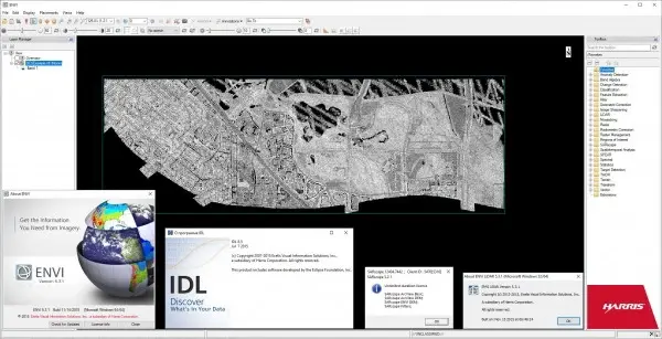
Exelis (ex. ITT) ENVI v5.3.1, IDL v8.5, LiDAR v5.3.1, SARscape v5.2.1 x64
ITT ENVI is a software product for visualization and processing of Earth remote sensing data.

Purpose - visualization and processing of remote sensing data; processing and analysis of multispectral and hyperspectral images; corrections of geometric and radiometric distortions; interactive image enhancement; spatial reference of the image; orthorectification; creation of DEM based on stereo images; three-dimensional visualization; interactive decryption and classification; vegetation analysis using NDVI indices; analysis of images in the radio range; vectorization of raster data; support for a wide range of raster and vector formats; calibration and atmospheric correction.
Advantages of the system - a wide range of input and output formats; there are no restrictions on the size of the processed images; automatic and manual vectorization of raster data; dynamic access to GIS and DBMS data; preparation of maps, and their printing; processing of hyperspectral images; contains tools that allow you to automate and make complex image processing and analysis (spectral and topographic analysis, as well as vegetation analysis) as user-friendly as possible; convenient on-line help (technical tips, using Internet resources); using formulas and filters in image processing.
ENVI LiDAR is an interactive geospatial software environment that lets you create realistic 3D visualizations and easily extract important features and products from raw LiDAR point cloud data. The elevation information contained within LiDAR can be used to create Digital Elevation Models or be included in your geospatial products like line-of-sight or right-of way analyzes. ENVI LiDAR can also be customized with the API to meet the unique needs of your organization.
SARscape allows processing of materials of radar surveys performed by synthetic aperture radars (SAR), and provides maximum support for existing sensors: RADARSAT-1/2, ENVISAT (ASAR), ALOS (PALSAR), TerraSAR-X, COSMO-SkyMed, ERS- 1/2, JERS-1, etc. SARscape's capabilities include radar interferometry (digital terrain models creation, movement detection), polarimetry (creation of composite polarimetric images, object classification), etc.
Size: 2.51 GB
Download
*
ITT ENVI is a software product for visualization and processing of Earth remote sensing data.

Purpose - visualization and processing of remote sensing data; processing and analysis of multispectral and hyperspectral images; corrections of geometric and radiometric distortions; interactive image enhancement; spatial reference of the image; orthorectification; creation of DEM based on stereo images; three-dimensional visualization; interactive decryption and classification; vegetation analysis using NDVI indices; analysis of images in the radio range; vectorization of raster data; support for a wide range of raster and vector formats; calibration and atmospheric correction.
Advantages of the system - a wide range of input and output formats; there are no restrictions on the size of the processed images; automatic and manual vectorization of raster data; dynamic access to GIS and DBMS data; preparation of maps, and their printing; processing of hyperspectral images; contains tools that allow you to automate and make complex image processing and analysis (spectral and topographic analysis, as well as vegetation analysis) as user-friendly as possible; convenient on-line help (technical tips, using Internet resources); using formulas and filters in image processing.
ENVI LiDAR is an interactive geospatial software environment that lets you create realistic 3D visualizations and easily extract important features and products from raw LiDAR point cloud data. The elevation information contained within LiDAR can be used to create Digital Elevation Models or be included in your geospatial products like line-of-sight or right-of way analyzes. ENVI LiDAR can also be customized with the API to meet the unique needs of your organization.
SARscape allows processing of materials of radar surveys performed by synthetic aperture radars (SAR), and provides maximum support for existing sensors: RADARSAT-1/2, ENVISAT (ASAR), ALOS (PALSAR), TerraSAR-X, COSMO-SkyMed, ERS- 1/2, JERS-1, etc. SARscape's capabilities include radar interferometry (digital terrain models creation, movement detection), polarimetry (creation of composite polarimetric images, object classification), etc.
Size: 2.51 GB
Download
*
