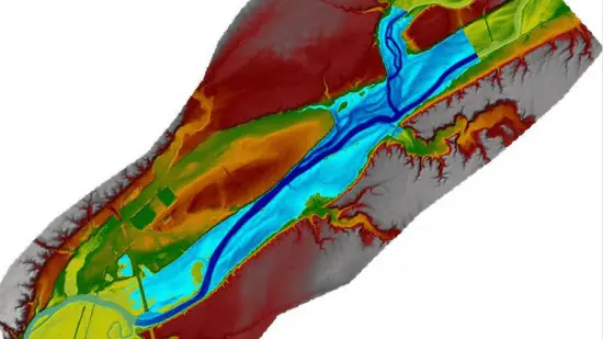
Flood Inundation Mapping using RS DEMs and RAS Mapper
Hydraulic Simulation

What you'll learn
You will learn how to Download remotely sensed DEMs for Your Study Area
You will learn how to Preprocess the raw DEMs in GIS Environment
You will learn how to Import DEMs into RAS Mapper in HEC-RAS 6
You will learn how to Extract River Cross-Sections in RAS Mapper
You will learn how to Run the HEC-RAS Model for Different Return Periods
You will learn how to Create Flood Extends, Depth Map and other Hydraulic Properties
Requirements
This course assumes no prior knowledge of Flood Modeling, and River Engineering Concepts and is presented from a practical point of view by a professional modeler.
Description
Flooding is one of the major natural disasters that affect many parts of the world and has led to huge amounts of property damage and human life losses, especially in developing countries. During the past 30 years, several hydraulic models have been developed and integrated with the Geographic Information Systems (GIS). The performance of these models depends on several factors, among them the choice of hydraulic model (1D or 2D), a correct representation of the river channel and floodplain geometry, model assumptions/ parameters, reliable boundary, and initial conditions are required to achieve accurate results, such as Flood Extent and Water Surface Elevation (WSE) along the river.
Among these factors, the geometric description of the floodplains and river channels has been reported to be one of the fundamental input data in hydraulic modeling and this input data can be obtained from the Digital Elevation Models (DEMs). Currently, there are several DEM sources that range from fine-resolution and accurate, but costly, to low-cost and low-resolution, such as ASTER (Advanced Spaceborne Thermal Emission and Reflection Radiometer), SRTM (Shuttle Radar Topography Mission), ALOS (Advanced Land Observing Satellite) and GTOPO30 (global 30 arc-second elevation).
In data-sparse regions accessing to ground high-quality topography maps is impossible, and so using Remotely Sensed based DEM is the best choice for flood inundation mapping or other hydraulic simulations. Therefore, in this course all required steps from downloading DEMs to Running and Visualizing the results in HEC-RAS 6 environment are described completely.
After finishing this course you will be able to extract flood maps for different return periods based on RS DEMs.
Who this course is for
For River Engineering, Flood Modeling Experts and Engineers, and Students of Water Resources Engineering
For Consultants or professionals interested in Flood Modeling, or hydraulic Calculation.
For under grade or Grade students who want to improve their skills in River Engineering Studies
Published 07/2022
MP4 | Video: h264, 1280x720 | Audio: AAC, 44.1 KHz, 2 Ch
Genre: eLearning | Language: English + srt | Duration: 5 lectures (1h 50m) | Size: 1.32 GB
Download
*
Hydraulic Simulation

What you'll learn
You will learn how to Download remotely sensed DEMs for Your Study Area
You will learn how to Preprocess the raw DEMs in GIS Environment
You will learn how to Import DEMs into RAS Mapper in HEC-RAS 6
You will learn how to Extract River Cross-Sections in RAS Mapper
You will learn how to Run the HEC-RAS Model for Different Return Periods
You will learn how to Create Flood Extends, Depth Map and other Hydraulic Properties
Requirements
This course assumes no prior knowledge of Flood Modeling, and River Engineering Concepts and is presented from a practical point of view by a professional modeler.
Description
Flooding is one of the major natural disasters that affect many parts of the world and has led to huge amounts of property damage and human life losses, especially in developing countries. During the past 30 years, several hydraulic models have been developed and integrated with the Geographic Information Systems (GIS). The performance of these models depends on several factors, among them the choice of hydraulic model (1D or 2D), a correct representation of the river channel and floodplain geometry, model assumptions/ parameters, reliable boundary, and initial conditions are required to achieve accurate results, such as Flood Extent and Water Surface Elevation (WSE) along the river.
Among these factors, the geometric description of the floodplains and river channels has been reported to be one of the fundamental input data in hydraulic modeling and this input data can be obtained from the Digital Elevation Models (DEMs). Currently, there are several DEM sources that range from fine-resolution and accurate, but costly, to low-cost and low-resolution, such as ASTER (Advanced Spaceborne Thermal Emission and Reflection Radiometer), SRTM (Shuttle Radar Topography Mission), ALOS (Advanced Land Observing Satellite) and GTOPO30 (global 30 arc-second elevation).
In data-sparse regions accessing to ground high-quality topography maps is impossible, and so using Remotely Sensed based DEM is the best choice for flood inundation mapping or other hydraulic simulations. Therefore, in this course all required steps from downloading DEMs to Running and Visualizing the results in HEC-RAS 6 environment are described completely.
After finishing this course you will be able to extract flood maps for different return periods based on RS DEMs.
Who this course is for
For River Engineering, Flood Modeling Experts and Engineers, and Students of Water Resources Engineering
For Consultants or professionals interested in Flood Modeling, or hydraulic Calculation.
For under grade or Grade students who want to improve their skills in River Engineering Studies
Published 07/2022
MP4 | Video: h264, 1280x720 | Audio: AAC, 44.1 KHz, 2 Ch
Genre: eLearning | Language: English + srt | Duration: 5 lectures (1h 50m) | Size: 1.32 GB
Download
*
