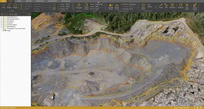
CREATE SURVEYS EFFICIENTLY FROM YOUR DRONE DATA
*
- Visualize your UAV image and elevation data in a 3D environment
- Runs on a simple laptop
- Terrain files can be streamed online
- Calculate volumes & volume differences
- Create reference level
- Visually remove terrain to reference level
- Automatically annotate elevation values
- Add 3D models to virtual environment
- Export CAD & GIS
- Simulate shadow casting
*

