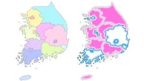
Solving Spatial problems with ArcGIS Desktop
Learn the software and solve problems.
What you'll learn
Understand the fundamentals of Geographical Information Systems and it applications
Create, configure and present maps in layout
understand and apply the steps to solve spatial problems
Get free spatial data from 10 different sources.
Create your own spatial data and make topological corrections.
Create thematic maps of different types
Automate map production processess
Share maps in webGIS and interactive PDFs
Apply 14 geoprocessing tools to solve spatial problems.
Use models to automate the spatial analysis process

Requirements
Willingness to learn and apply spatial technology in your day-to-day life.
No GIS experience is required, everything will be taught from scratch until the advanced level.
Basic window familiarity is important such as creating folders, copying files, exploring directories, editing text with word processing, opening and converting excel files to different formats.
You will need a license for the software.
If you do no have, you can use the trial version,available in the ESRI website
Description
This course will teach you how to use a GIS software to solve spatial problems and produce results for informed decision making.
After finishing the course, you will be comfortable in the use of ArcGIS Desktop and the steps that takes to use the software to solve spatial problems.
Your learning will includes.
Know the fundamentals of GIS and its applications.
Create and configure maps.
Measure distances, length and areas.
Use the GPS receiver data to create spatial data.
Produce thematic maps of different types.
Produce map layout in different size (A4, A3 and A0), and export the map to different formats.
Make attribute and location query to your data.
Download free spatial data from the internet.
Produce advanced thematic maps and graphics.
Automate map production for lots of maps in short period.
Use batch processing to process lots of maps.
Create interactive PDFs.
Choose the right projection and coordinate system for your work.
Create spatial database.Georeferencing Google earth and other raster images.
Create spatial data (digitalization) and make topological corrections.
Use geoprocessing tools to solve spatial problems.
Understand the steps in GIS analysis.
Automate GIS analyze process with model builder.
Create accessibility to services maps.
Create potential impact maps.
Create Rural Accessibility Index (RAI)Share your information in ArcGIS Online.
Who this course is for
University students working in geographical related course such as geography, geology, agronomy, economics and biology.
Employees of government and private institutions, such as ministries of planning, agriculture, land and environment, public works, health and education.
Researcher and managers working with spatial data
Anyone interested in using spatial information for decision making
Published 6/2023
Created by Paulo Covele
MP4 | Video: h264, 1280x720 | Audio: AAC, 44.1 KHz, 2 Ch
Genre: eLearning | Language: English | Duration: 133 Lectures ( 12h 41m ) | Size: 6.58 GB
Download
http://s19.alxa.net/one/2024/05/Sol...IS.Desktop.rar
Learn the software and solve problems.
What you'll learn
Understand the fundamentals of Geographical Information Systems and it applications
Create, configure and present maps in layout
understand and apply the steps to solve spatial problems
Get free spatial data from 10 different sources.
Create your own spatial data and make topological corrections.
Create thematic maps of different types
Automate map production processess
Share maps in webGIS and interactive PDFs
Apply 14 geoprocessing tools to solve spatial problems.
Use models to automate the spatial analysis process

Requirements
Willingness to learn and apply spatial technology in your day-to-day life.
No GIS experience is required, everything will be taught from scratch until the advanced level.
Basic window familiarity is important such as creating folders, copying files, exploring directories, editing text with word processing, opening and converting excel files to different formats.
You will need a license for the software.
If you do no have, you can use the trial version,available in the ESRI website
Description
This course will teach you how to use a GIS software to solve spatial problems and produce results for informed decision making.
After finishing the course, you will be comfortable in the use of ArcGIS Desktop and the steps that takes to use the software to solve spatial problems.
Your learning will includes.
Know the fundamentals of GIS and its applications.
Create and configure maps.
Measure distances, length and areas.
Use the GPS receiver data to create spatial data.
Produce thematic maps of different types.
Produce map layout in different size (A4, A3 and A0), and export the map to different formats.
Make attribute and location query to your data.
Download free spatial data from the internet.
Produce advanced thematic maps and graphics.
Automate map production for lots of maps in short period.
Use batch processing to process lots of maps.
Create interactive PDFs.
Choose the right projection and coordinate system for your work.
Create spatial database.Georeferencing Google earth and other raster images.
Create spatial data (digitalization) and make topological corrections.
Use geoprocessing tools to solve spatial problems.
Understand the steps in GIS analysis.
Automate GIS analyze process with model builder.
Create accessibility to services maps.
Create potential impact maps.
Create Rural Accessibility Index (RAI)Share your information in ArcGIS Online.
Who this course is for
University students working in geographical related course such as geography, geology, agronomy, economics and biology.
Employees of government and private institutions, such as ministries of planning, agriculture, land and environment, public works, health and education.
Researcher and managers working with spatial data
Anyone interested in using spatial information for decision making
Published 6/2023
Created by Paulo Covele
MP4 | Video: h264, 1280x720 | Audio: AAC, 44.1 KHz, 2 Ch
Genre: eLearning | Language: English | Duration: 133 Lectures ( 12h 41m ) | Size: 6.58 GB
Download
http://s19.alxa.net/one/2024/05/Sol...IS.Desktop.rar