Trimble Inpho UASMaster 14.1.1
Trimble has released Incho UASMaster 14.1.1 is the perfect tool for complete data processing with unmanned aerial vehicle (UAS) systems, and combines the ease of use with the full power of a photography workstation.
Trimble UASMaster version 14.1 highlights:
The latest version of UASMaster v14.1 introduces a major improvement in feature detection performance. The introduction of a new partitioning algorithm for feature detection enables parallel processing. This feature allows processing of any block geometry, not just rectangular blocks as well as delivering significantly enhanced processing time.
There are more features in this version that will ease your production, and can be found in the Release Notes. As usual, the Inpho team has improved the stability and usability through bug fixes in version 14.1.
Trimble UASMaster Version 14.1.1
Trimble announces a patch for version 14.1. The reason for this version is bug fixes.
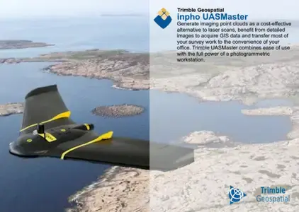
Trimble Inpho software is designed to precisely transform raw aerial and satellite images into consistent and accurate point clouds and surface models, orthophoto mosaics and digitized 3D features using state-of-the-art photogrammetry techniques. These essential processes standardize and enhance geospatial data for national mapping, forestry, agriculture, mining, utility and energy, urban development, defense and disaster response geo-information workflows.
Inpho UASMaster combines ease of use with the full power of a photogrammetric workstation. The software bridges the gap between simple near black-box workflows for nonphotogrammetrists and photogrammetry expert workflows. UASMaster includes advanced technology to provide high quality results. It easily integrates into the Inpho world of photogrammetry, into Trimble Business Center as well as into many 3rd party workflows. With its open market concept, UASMaster is able to process data from almost every hardware vendor for UAS. It works with acquired data from fixed-wing vehicles as well as with multi-copters and even hand-held cameras. For 3D reconstruction projects, depending on project requirements, the only mandatory data is imagery – no need to know camera parameters, approximate image georeferences or ground control.
In this session, you will learn how to perform your photogrammetry projects in Trimble Business Center (TBC) through three simple steps. Additionally, you will learn the main differences between TBC Photogrammetry and Trimble UASMaster.
Trimble Geospatial provides solutions that facilitate high-quality, productive workflows and information exchange, driving value for a global and diverse customer base of surveyors, engineering and GIS service companies, governments, utilities and transportation authorities. Trimble’s innovative technologies include integrated sensors, field applications, real-time communications and office software for processing, modelling and data analytics.
Owner: Trimble Geospatial
Product Name: Incho UASMaster
Version: 14.1.1
Supported Architectures: x64
Languages Supported: english
System Requirements: Windows *
Trimble Inpho UASMaster 14.1.1 | 2.82 Gb
Download
http://s9.alxa.net/one/2024/08/Trimb...ter.14.1.1.rar
Trimble has released Incho UASMaster 14.1.1 is the perfect tool for complete data processing with unmanned aerial vehicle (UAS) systems, and combines the ease of use with the full power of a photography workstation.
Trimble UASMaster version 14.1 highlights:
The latest version of UASMaster v14.1 introduces a major improvement in feature detection performance. The introduction of a new partitioning algorithm for feature detection enables parallel processing. This feature allows processing of any block geometry, not just rectangular blocks as well as delivering significantly enhanced processing time.
There are more features in this version that will ease your production, and can be found in the Release Notes. As usual, the Inpho team has improved the stability and usability through bug fixes in version 14.1.
Trimble UASMaster Version 14.1.1
Trimble announces a patch for version 14.1. The reason for this version is bug fixes.
Trimble Inpho software is designed to precisely transform raw aerial and satellite images into consistent and accurate point clouds and surface models, orthophoto mosaics and digitized 3D features using state-of-the-art photogrammetry techniques. These essential processes standardize and enhance geospatial data for national mapping, forestry, agriculture, mining, utility and energy, urban development, defense and disaster response geo-information workflows.
Inpho UASMaster combines ease of use with the full power of a photogrammetric workstation. The software bridges the gap between simple near black-box workflows for nonphotogrammetrists and photogrammetry expert workflows. UASMaster includes advanced technology to provide high quality results. It easily integrates into the Inpho world of photogrammetry, into Trimble Business Center as well as into many 3rd party workflows. With its open market concept, UASMaster is able to process data from almost every hardware vendor for UAS. It works with acquired data from fixed-wing vehicles as well as with multi-copters and even hand-held cameras. For 3D reconstruction projects, depending on project requirements, the only mandatory data is imagery – no need to know camera parameters, approximate image georeferences or ground control.
In this session, you will learn how to perform your photogrammetry projects in Trimble Business Center (TBC) through three simple steps. Additionally, you will learn the main differences between TBC Photogrammetry and Trimble UASMaster.
Trimble Geospatial provides solutions that facilitate high-quality, productive workflows and information exchange, driving value for a global and diverse customer base of surveyors, engineering and GIS service companies, governments, utilities and transportation authorities. Trimble’s innovative technologies include integrated sensors, field applications, real-time communications and office software for processing, modelling and data analytics.
Owner: Trimble Geospatial
Product Name: Incho UASMaster
Version: 14.1.1
Supported Architectures: x64
Languages Supported: english
System Requirements: Windows *
Trimble Inpho UASMaster 14.1.1 | 2.82 Gb
Download
http://s9.alxa.net/one/2024/08/Trimb...ter.14.1.1.rar