Trimble Inpho Photogrammetry 14.1.1
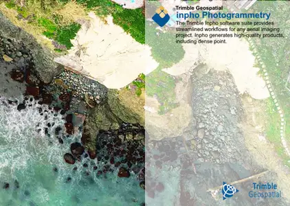
Trimble has released Incho Photogrammetry 14.1.1 is designed to precisely transform raw aerial and satellite images into consistent and accurate point clouds and surface models, orthophoto mosaics and digitized 3D features using state-of-the-art photogrammetry techniques.
Trimble Inpho version 14.1 highlights:
Orthovista—delivers enhancements in feature detection processing for non-rectangular blocks and enhanced partitioning capabilities.
MATCH-AT—improved loading times in ApplicationsMaster and PMT, enhanced ground control point management and tie point extraction extended to shoreline projects.
MATCH-T—improvements in point cloud processing, and DTM (Digital Terrain Model) generation.
MATCH-3DX—optimized the determination of oblique angles, elevating the threshold for increased accuracy and precision, ensuring oblique data is handled with greater clarity, enhanced True-Ortho image production, and mesh generation.
Trimble Inpho Version 14.1.1
Trimble announces the patch version 14.1.1. The reason for this version is bug fixes.
Trimble Inpho software is designed to precisely transform aerial images into consistent and accurate point clouds and surface models, orthophoto mosaics and digitized 3D features using state-of-the-art photogrammetry and remote sensing techniques. The modules can be used as a complete system or as individual components which integrate easily into any photogrammetric production workflow using 3rd party products. The portfolio also includes point-cloud and terrain modeling for massive data as well as airborne LiDAR scanning processing completed by automated city-modeling software. Inpho is compatible with state-of-the-art photogrammetric camera systems from Trimble, Leica, Vexcel, IGI, Phaseone or others.
This webinar is dedicated to orthophoto production workflows. We will introduce you to the workflows available within Trimble Inpho software and share our experiences. It doesn’t matter whether you are an advanced user or just a beginner, grab a coffee and enjoy the webinar!
Trimble Geospatial provides solutions that facilitate high-quality, productive workflows and information exchange, driving value for a global and diverse customer base of surveyors, engineering and GIS service companies, governments, utilities and transportation authorities. Trimble’s innovative technologies include integrated sensors, field applications, real-time communications and office software for processing, modelling and data analytics.
Owner: Trimble Geospatial
Product Name: Incho Photogrammetry
Version: 14.1.1
Supported Architectures: x64
Languages Supported: english
System Requirements: Windows *
Trimble Inpho Photogrammetry 14.1.1 | 3.42 Gb
Download
http://s9.alxa.net/one/2024/08/Trimb...try.14.1.1.rar
