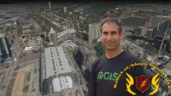
Point Cloud Processing and 3D Visualization with QGIS
Unlock the potential of point cloud data in QGIS with its new processing tools, 3D rendering features and PDAL wrench.

What you'll learn:
Define point cloud data
Find point cloud data sources and tools
Create and use Virtual Point Clouds (VPC)
Interpolate point cloud data to raster
Visualize point cloud data in 2D and 3D
Filter point cloud data
Automate point cloud processing with PDAL wrench
Requirements:
Good computer skills, basic knowledge of the command line
The course assumes that the participants have some basic knowledge of QGIS and GIS concepts, but no prior experience with point cloud data is required.
You'll need QGIS 3.34 or newer. The course provides installation instructions for Microsoft Windows only. Installation for other operating systems is not covered by the course.
For this course you need to have a computer with a good graphics card. 16 GB RAM and a large hard disk are recommended.
Description:
Welcome to this course on point cloud processing and 3D visualization with QGIS!If you are a QGIS user who is eager to improve your skills by learning how to handle point cloud data, this course is for you.In this course you will learn how to:Download and preprocess point cloud data from various sources Interpolate point cloud data to create digital elevation models and other raster products Visualize point cloud data in 3D using the QGIS 3D view and Elevation Profile toolFilter point cloud data Automate point cloud processing workflows using PDAL wrench The course is structured into 8 sections, each containing videos, quizzes, and assignments to help you master the concepts and techniques.
You will use only open data and QGIS throughout the course. By the end of the course, you will have a solid foundation in point cloud processing and 3D mapping, and you will be able to create stunning 3D scenes of your study area!I assume that you are a Windows user. All instructions are for Windows. If you're using another operating system and get stuck, you need to find solutions on the internet.I hope you are excited to join this course and discover the power of QGIS and point clouds. To get a glimpse of what you will learn, please watch the course promo video and check out the free previews. I can’t wait to see you on the course!
Who this course is for:
The course is suitable for GIS specialists who want to explore the potential of point cloud data for spatial analysis and visualization
Urban planners
Students
Academics
Researchers
Published 1/2024
Created by Hans van der Kwast
MP4 | Video: h264, 1280x720 | Audio: AAC, 44.1 KHz, 2 Ch
Genre: eLearning | Language: English | Duration: 34 Lectures ( 1h 32m ) | Size: 1.38 GB
Download
http://s9.alxa.net/one/2024/09/Point....with.QGIS.rar
Unlock the potential of point cloud data in QGIS with its new processing tools, 3D rendering features and PDAL wrench.

What you'll learn:
Define point cloud data
Find point cloud data sources and tools
Create and use Virtual Point Clouds (VPC)
Interpolate point cloud data to raster
Visualize point cloud data in 2D and 3D
Filter point cloud data
Automate point cloud processing with PDAL wrench
Requirements:
Good computer skills, basic knowledge of the command line
The course assumes that the participants have some basic knowledge of QGIS and GIS concepts, but no prior experience with point cloud data is required.
You'll need QGIS 3.34 or newer. The course provides installation instructions for Microsoft Windows only. Installation for other operating systems is not covered by the course.
For this course you need to have a computer with a good graphics card. 16 GB RAM and a large hard disk are recommended.
Description:
Welcome to this course on point cloud processing and 3D visualization with QGIS!If you are a QGIS user who is eager to improve your skills by learning how to handle point cloud data, this course is for you.In this course you will learn how to:Download and preprocess point cloud data from various sources Interpolate point cloud data to create digital elevation models and other raster products Visualize point cloud data in 3D using the QGIS 3D view and Elevation Profile toolFilter point cloud data Automate point cloud processing workflows using PDAL wrench The course is structured into 8 sections, each containing videos, quizzes, and assignments to help you master the concepts and techniques.
You will use only open data and QGIS throughout the course. By the end of the course, you will have a solid foundation in point cloud processing and 3D mapping, and you will be able to create stunning 3D scenes of your study area!I assume that you are a Windows user. All instructions are for Windows. If you're using another operating system and get stuck, you need to find solutions on the internet.I hope you are excited to join this course and discover the power of QGIS and point clouds. To get a glimpse of what you will learn, please watch the course promo video and check out the free previews. I can’t wait to see you on the course!
Who this course is for:
The course is suitable for GIS specialists who want to explore the potential of point cloud data for spatial analysis and visualization
Urban planners
Students
Academics
Researchers
Published 1/2024
Created by Hans van der Kwast
MP4 | Video: h264, 1280x720 | Audio: AAC, 44.1 KHz, 2 Ch
Genre: eLearning | Language: English | Duration: 34 Lectures ( 1h 32m ) | Size: 1.38 GB
Download
http://s9.alxa.net/one/2024/09/Point....with.QGIS.rar