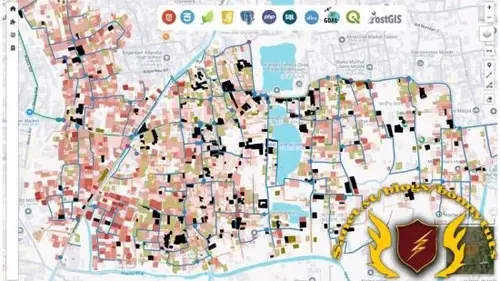
WebGIS: From Beginner to Advance
Developing Interactive GIS Platforms with Server Side Technologies

What you'll learn:
Fundamentals of web development with HTML, CSS, and Bootstrap.
Developing interactive user interfaces using JavaScript and jQuery.
How to use Leaflet and its plugins to create functional web maps.
Loading, styling, and displaying your own data in a WebGIS environment.
Querying spatial data and displaying the results separately in WebGIS.
Hosting PostgreSQL on both local systems and cloud platforms.
Storing and retrieving spatial data from PostgreSQL databases.
Basic SQL commands to interact with databases.
Using server-side scripting with PHP.
Performing real-time data updates, inserts, and deletes in a WebGIS system.
Implementing a tile-based approach to display raster data on WebGIS platforms.
Setting up hosting services to make your WebGIS accessible from anywhere in the world.
Requirements:
You need to have a working knowledge on GIS. If you can make some maps using ArcGIS or QGIS, then it is good enough.
No programming experience needed. I will teach you everything step by step.
Description:
This course is designed for anyone who wants to learn WebGIS from the ground up, even if you’re starting from scratch. While there are many WebGIS courses out there, few provide a complete, structured path from beginner to advanced levels. Most courses focus on either beginners or experts, but this course takes you on a comprehensive journey that covers everything—from the basics to more advanced concepts.No prior programming experience is necessary. Everything is taught step by step, with a focus on building your skills progressively.
You don’t need to be a GIS expert; as long as you have a desire to learn, you’ll be ready to succeed.In this course, I will guide you through:HTML CSS JavaScript Bootstrapj Query Leaflet PHP Postgre SQL Post GIS SQL GDALBy the end of the course, you will have gained the skills to combine both client-side and server-side technologies to create a fully functional WebGIS system. You’ll be able to handle real-time data insertion, updates, and deletion operations efficiently. Users will be able to query data seamlessly through an intuitive Graphical User Interface (GUI) that you design.And finally, we’ll make your WebGIS system accessible from anywhere in the world, ensuring that your data and tools are available to anyone, anytime!
Who this course is for:
GIS Professionals.
Students willing to learn advanced GIS.
Basically for anyone who is interested in mapping and want to develop his/her skills in GIS.
Published 9/2024
Created by Md. Touhidur Rahman
MP4 | Video: h264, 1280x720 | Audio: AAC, 44.1 KHz, 2 Ch
Genre: eLearning | Language: English | Duration: 93 Lectures ( 18h 1m ) | Size: 10.5 GB
Download
*
Developing Interactive GIS Platforms with Server Side Technologies

What you'll learn:
Fundamentals of web development with HTML, CSS, and Bootstrap.
Developing interactive user interfaces using JavaScript and jQuery.
How to use Leaflet and its plugins to create functional web maps.
Loading, styling, and displaying your own data in a WebGIS environment.
Querying spatial data and displaying the results separately in WebGIS.
Hosting PostgreSQL on both local systems and cloud platforms.
Storing and retrieving spatial data from PostgreSQL databases.
Basic SQL commands to interact with databases.
Using server-side scripting with PHP.
Performing real-time data updates, inserts, and deletes in a WebGIS system.
Implementing a tile-based approach to display raster data on WebGIS platforms.
Setting up hosting services to make your WebGIS accessible from anywhere in the world.
Requirements:
You need to have a working knowledge on GIS. If you can make some maps using ArcGIS or QGIS, then it is good enough.
No programming experience needed. I will teach you everything step by step.
Description:
This course is designed for anyone who wants to learn WebGIS from the ground up, even if you’re starting from scratch. While there are many WebGIS courses out there, few provide a complete, structured path from beginner to advanced levels. Most courses focus on either beginners or experts, but this course takes you on a comprehensive journey that covers everything—from the basics to more advanced concepts.No prior programming experience is necessary. Everything is taught step by step, with a focus on building your skills progressively.
You don’t need to be a GIS expert; as long as you have a desire to learn, you’ll be ready to succeed.In this course, I will guide you through:HTML CSS JavaScript Bootstrapj Query Leaflet PHP Postgre SQL Post GIS SQL GDALBy the end of the course, you will have gained the skills to combine both client-side and server-side technologies to create a fully functional WebGIS system. You’ll be able to handle real-time data insertion, updates, and deletion operations efficiently. Users will be able to query data seamlessly through an intuitive Graphical User Interface (GUI) that you design.And finally, we’ll make your WebGIS system accessible from anywhere in the world, ensuring that your data and tools are available to anyone, anytime!
Who this course is for:
GIS Professionals.
Students willing to learn advanced GIS.
Basically for anyone who is interested in mapping and want to develop his/her skills in GIS.
Published 9/2024
Created by Md. Touhidur Rahman
MP4 | Video: h264, 1280x720 | Audio: AAC, 44.1 KHz, 2 Ch
Genre: eLearning | Language: English | Duration: 93 Lectures ( 18h 1m ) | Size: 10.5 GB
Download
*