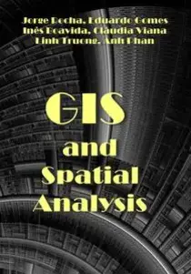
GIS and Spatial Analysis
This volume is a critical book that provides different methodologies that combine the potential data (including Big Data) analysis with GIS applications. It gives readers a comprehensive overview of the current state-of-the-art methods of spatial analysis, focusing both on the new philosophical and theoretical foundations for spatial analysis and on a flexible framework for analysis in the real world, for problems such as complexity and uncertainty.

The objective of spatial analysis techniques is to describe the patterns existing in spatial data and to establish, preferably quantitatively, the relationships between different geographic variables. The notion of spatial analysis in a Geographic Information Systems (GIS) environment encompasses the idea of integrating spatial data and alphanumeric attributes and translating it into a series of functions related to selection and data search, on the one hand, and with modeling, on the other. There have been substantial advances in spatial analysis techniques in GIS, mainly in the form of more faithfully apprehending the relationships inherent to the geographic phenomenon, something that was proven impossible to do with non-spatial techniques. Nowadays, spatial analysis involves a set of techniques used to analyze and model variables with distribution in space and/or time. The new era of spatial analysis must also consider the possibilities of integrating artificial intelligence in simulation (geosimulation) processes in computerized environments (geocomputation) in close relationship with models developed in real situations. GIS have emerged as useful tools in geographic modeling processes, helping to answer questions about the time variability of the landscape structure, study the behavior of fire, predict areas of urban expansion, analyze propagation phenomena, model animal movement and behavior, and determine periods and areas of high risk of flooding, among other phenomena.
Contents
1. GIS and Spatial Analysis
2. The Socio-Economic Factors of the Covid-19 Pandemic in Turkey: A Spatial Perspective
3. Spatial Analysis of Climate Driver Impacts on Sub-Saharan African Migration Patterns in Tanzania
4. Dynamics, Anomalies and Boundaries of the Forest-Savanna Transition: A Novel Remote Sensing-Based Multi-Angles Methodology Using Google Earth Engine
5. The Metropolitan Transformation of Ioannina City from 1940 to 2015
6. Using Geospatial Analysis to Assist with Clean Vehicle Infrastructure
7. GIS and Database Management for Mining Exploration
8. The Geomagnetic Field Transformants and Their Complexing with Data of Gravitational, Thermal and Radioactive Fields: During the Exploration of Hydrocarbon Fields at the Southern Part of the Ustyurt Region
9. Spaceborne LiDAR Surveying and Mapping
10. Modeling the Use of LiDAR through Adverse Weather
ITexLi | 2023 | ISBN: 1803565977 9781803565972 1803565969 9781803565965 1803565985 9781803565989 | 206 pages | PDF | 61 MB
Download
http://s9.alxa.net/one/2024/09/GIS.a...l.Analysis.rar
This volume is a critical book that provides different methodologies that combine the potential data (including Big Data) analysis with GIS applications. It gives readers a comprehensive overview of the current state-of-the-art methods of spatial analysis, focusing both on the new philosophical and theoretical foundations for spatial analysis and on a flexible framework for analysis in the real world, for problems such as complexity and uncertainty.

The objective of spatial analysis techniques is to describe the patterns existing in spatial data and to establish, preferably quantitatively, the relationships between different geographic variables. The notion of spatial analysis in a Geographic Information Systems (GIS) environment encompasses the idea of integrating spatial data and alphanumeric attributes and translating it into a series of functions related to selection and data search, on the one hand, and with modeling, on the other. There have been substantial advances in spatial analysis techniques in GIS, mainly in the form of more faithfully apprehending the relationships inherent to the geographic phenomenon, something that was proven impossible to do with non-spatial techniques. Nowadays, spatial analysis involves a set of techniques used to analyze and model variables with distribution in space and/or time. The new era of spatial analysis must also consider the possibilities of integrating artificial intelligence in simulation (geosimulation) processes in computerized environments (geocomputation) in close relationship with models developed in real situations. GIS have emerged as useful tools in geographic modeling processes, helping to answer questions about the time variability of the landscape structure, study the behavior of fire, predict areas of urban expansion, analyze propagation phenomena, model animal movement and behavior, and determine periods and areas of high risk of flooding, among other phenomena.
Contents
1. GIS and Spatial Analysis
2. The Socio-Economic Factors of the Covid-19 Pandemic in Turkey: A Spatial Perspective
3. Spatial Analysis of Climate Driver Impacts on Sub-Saharan African Migration Patterns in Tanzania
4. Dynamics, Anomalies and Boundaries of the Forest-Savanna Transition: A Novel Remote Sensing-Based Multi-Angles Methodology Using Google Earth Engine
5. The Metropolitan Transformation of Ioannina City from 1940 to 2015
6. Using Geospatial Analysis to Assist with Clean Vehicle Infrastructure
7. GIS and Database Management for Mining Exploration
8. The Geomagnetic Field Transformants and Their Complexing with Data of Gravitational, Thermal and Radioactive Fields: During the Exploration of Hydrocarbon Fields at the Southern Part of the Ustyurt Region
9. Spaceborne LiDAR Surveying and Mapping
10. Modeling the Use of LiDAR through Adverse Weather
ITexLi | 2023 | ISBN: 1803565977 9781803565972 1803565969 9781803565965 1803565985 9781803565989 | 206 pages | PDF | 61 MB
Download
http://s9.alxa.net/one/2024/09/GIS.a...l.Analysis.rar