Gis Data Analysis with ArcGis Desktop
What you'll learn
Learn Plateforme of ArcGIS Desktop (ArcMap,ArcCatalog,ArcToolbox)
Projects and data organization
Adding CAD data to a map and Displaying CAD features
Using data frames
Convert dwg file (line) to shapefile (polyline)
Delete Records from polyline shapefile attribute table
Splittings lines manually
Adding new records to a table
Editing vertices and segments
Extend line to specific distance
Use geoprossing tools to convert line Feature To Polygon
Change transparency of a layer
Using the Cut Polygons tool
Convert an annotation feature class to Point
Deleting columns fields from polygon shapefile attribute table
Delete Rows from point shapefile attribute table
Using Select By Location
Creating a new shapefile Feature Type point
Switching the selected set in a table
Spatial joins by feature type (Analysis)
Using Select by Attributes
Buffer
An outline of analytical operations (Intersect,Union)
Copying and pasting features
Create a file geodatabase and Import data shapefile into geodatabase
Multipart to singlepart
Working with color
Using the Label Manager
Creating and digitizing features (lines)
Merging shapefiles in ArcGIS by using the Merge tool
Splitting lines at a specified distance or percentage
Adding fields to a polygone shapefile attribute table
Clip shapefile in ArcGIS
Saving a map
Making field calculations
The Calculate Geometry tool
Joining Excel to attribute table in ArcGIS
Page layouts

Requirements
Access to ArcGIS Desktop version 10 or above
Description
The preparation of data and the constitution of the database is an essential stage of GIS projects. In most cases, this is the most delicate and costly phase in terms of time and investment. Particular attention is therefore paid to this step to meet the needs of structuring and enhancing data. Indeed, without data the GIS solution will have no importance because the outputs and the results of the system largely depend on the quantity and the quality of the data integrated in the database. For this, the work of structuring the GIS database from all the data available at the level of "Ministry of cohesion of the territory" constitutes the primary need and a sine qua non condition for the success of the GIS project. .
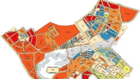
It is a GIS project on the constitution and structuring of the GIS database of "Ministry of cohesion of the territory". It thus covers the operations of data acquisition, preparation and integration. Thus, the missions of this project are:
• Data acquisition and preparation
• Migration and structuring of data in GIS format (conversion of data from CAD format (AutoCAD) to GIS format).
• Using spatial analysis.
• Constitution of the GIS database.
Who this course is for:
GIS,Architect, Data Science,Urban Planning,Topography.
Genre: eLearning | MP4 | Video: h264, 1280x720 | Audio: aac, 44100 Hz
Language: English | VTT | Size: 1.79 GB | Duration: 2h 41m
Download
*
What you'll learn
Learn Plateforme of ArcGIS Desktop (ArcMap,ArcCatalog,ArcToolbox)
Projects and data organization
Adding CAD data to a map and Displaying CAD features
Using data frames
Convert dwg file (line) to shapefile (polyline)
Delete Records from polyline shapefile attribute table
Splittings lines manually
Adding new records to a table
Editing vertices and segments
Extend line to specific distance
Use geoprossing tools to convert line Feature To Polygon
Change transparency of a layer
Using the Cut Polygons tool
Convert an annotation feature class to Point
Deleting columns fields from polygon shapefile attribute table
Delete Rows from point shapefile attribute table
Using Select By Location
Creating a new shapefile Feature Type point
Switching the selected set in a table
Spatial joins by feature type (Analysis)
Using Select by Attributes
Buffer
An outline of analytical operations (Intersect,Union)
Copying and pasting features
Create a file geodatabase and Import data shapefile into geodatabase
Multipart to singlepart
Working with color
Using the Label Manager
Creating and digitizing features (lines)
Merging shapefiles in ArcGIS by using the Merge tool
Splitting lines at a specified distance or percentage
Adding fields to a polygone shapefile attribute table
Clip shapefile in ArcGIS
Saving a map
Making field calculations
The Calculate Geometry tool
Joining Excel to attribute table in ArcGIS
Page layouts

Requirements
Access to ArcGIS Desktop version 10 or above
Description
The preparation of data and the constitution of the database is an essential stage of GIS projects. In most cases, this is the most delicate and costly phase in terms of time and investment. Particular attention is therefore paid to this step to meet the needs of structuring and enhancing data. Indeed, without data the GIS solution will have no importance because the outputs and the results of the system largely depend on the quantity and the quality of the data integrated in the database. For this, the work of structuring the GIS database from all the data available at the level of "Ministry of cohesion of the territory" constitutes the primary need and a sine qua non condition for the success of the GIS project. .
It is a GIS project on the constitution and structuring of the GIS database of "Ministry of cohesion of the territory". It thus covers the operations of data acquisition, preparation and integration. Thus, the missions of this project are:
• Data acquisition and preparation
• Migration and structuring of data in GIS format (conversion of data from CAD format (AutoCAD) to GIS format).
• Using spatial analysis.
• Constitution of the GIS database.
Who this course is for:
GIS,Architect, Data Science,Urban Planning,Topography.
Genre: eLearning | MP4 | Video: h264, 1280x720 | Audio: aac, 44100 Hz
Language: English | VTT | Size: 1.79 GB | Duration: 2h 41m
Download
*